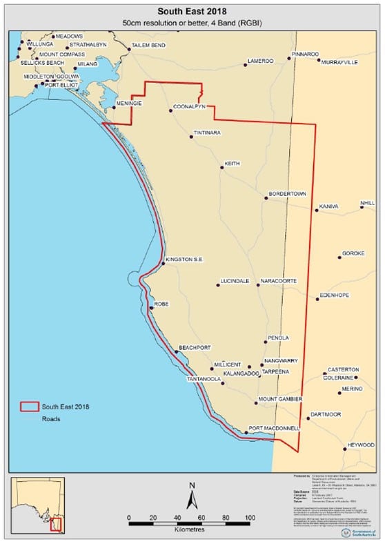
This summer, Vinehealth Australia’s aerial land capture is focused on the Limestone Coast, including the wine regions of Robe, Mount Benson, Padthaway, Wrattonbully, Coonawarra, Mount Gambier and Bordertown.
The capture (see figure 1) is a 4 band (RGBI) using a Leica ADS 100 camera, set at a spatial resolution of 30cm for the region. Growers are encouraged to contact Vinehealth Australia’s office if they are interested in aerial imagery or PCD/NDVI outputs which will be available from mid-April.
As a statutory body, Vinehealth Australia endeavours to leverage its government-associated value, and this flight capture is a shining example, with coordination being undertaken by the Department of Environment, Water and Natural Resources.
Most recently, we have explored opportunities to become part of the state government’s software licensing agreements. There is an associated substantial cost-saving, allowing us to direct these savings into biosecurity programs for growers. We are pleased to advise growers that we have already taken advantage of government software licensing agreements for both Microsoft and ESRI (for our mapping services), and look forward to announcing more in the future.
For more information phone (08) 8273 0550.
